GLOSSARY FOR 13 PRE-OWES LESSONS
Lesson 1
Hydric – For wetland evaluation purposes, hydric substrates are characterized by: rock, mineral or organic substrates with an ELC Moisture Regimes (MR) of ≥ 6, 7, 8, 9; or saturated rock, mineral or organic substrates (ELC category “s”); or an ELC MR of 5 (i.e, near-hydric), considered “moist” which may support hydrophytic or water-tolerant vegetation
Hydrophytic plants – Plant species suited to grow in water or in saturated soil conditions.
OWES – The Ontario Wetlands Evaluation System. Lesson 2 elaborates on this. See the resource section and gain access to an online OWES Manual.
Sedges – Any plant belonging to the family Cyperaceae which includes Carex species, cotton-grass (Eriophorum sp.), spike-rush (Eleocharis sp.), bulrush and clubrush (Scirpus sp.), umbrella-sedge (Cyperus sp.) and beak-rush (Rynchospora sp.).
Sphagnum moss – Sphagnum is a genus of about 380 species of mosses, many of which do well in acidic environments, and so are commonly found in bogs.
Water table – The upper surface of “the zone of saturation” where the pores and fractures of the ground are filled with water.
Lesson 2
CLTIP – The Conservation Land Tax Incentive Program is a voluntary program designed to recognize, encourage and support the long term sound stewardship of Ontario’s provincially significant lands. It offers tax exemption to those landowners who agree to protect the natural heritage values of their property.
CWS – The Canadian Wildlife Service.
OMNR – The Ontario Ministry of Natural Resources; this government department was renamed the Ministry of Natural Resources and Forestry (MNRF) in 2014.
PPS – The Provincial Policy Statement provides policy direction on matters of provincial interest related to land-use planning and development. As a key part of Ontario’s policy-led planning system, the Provincial Policy Statement sets the policy foundation for regulating the development and use of land, including wetlands.
PSW – Refers to a “provincially significant wetland”. This is a particularly valuable wetland that scores either i) 600 points or more out of 1000 potential points available in the OWES system, or ii) 200 points or more out of 250 potential points in either the Biological or Special Features Components of the OWES system. See the OWES Manuals for more details.
Lesson 3
4 components – Refers to the 4 components (Biological, Social, Hydrological and Special Features) that make up the backbone of the scoring criteria for OWES.
Dietary requirements – Information about the planned menu can be found at the Nipissing University OWES Webpage. While enrolling for an OWES course, you will be asked to provide information about any special dietary requirements you may have. Communications will then ensue to make sure that your needs are accommodated.
Lesson 4
Digital imagery interpretation – Refers to interpreting remotely sensed digital images and information. In the context of OWES, the interpretation would be aimed at establishing the boundaries of the wetland, the size of vegetation communities, the percentage of open water, and other information important to wetland evaluation.
GIS – A Geographic Information System (GIS) is a system designed to capture, store, manipulate, analyze, manage, and present spatial or geographic data. GIS is used to facilitate the evaluation of wetlands in OWES.
Remote sensing imagery – Refers to imagery that has been recorded by specialized equipment aboard satellites or high-flying aircraft. Passive remote sensors include film photography, infrared, and radiometers. Active collection involves emitting energy, such as radar or lidar, in order to scan objects, and then measuring the radiation that is reflected or backscattered from the target.
Lesson 5
Air photo interpretation – Refers to interpreting photographs that have been taken from aircraft or other flying objects
“Boot-level” wetland ecology – Refers to going into the wetland by foot to examine the numerous variables that can only be documented, or can best be verified, with visits to all parts of the wetland.
Lesson 6
“At risk” species – These are species that are classified as extirpated, endangered, threatened or of special concern in Ontario, as described in Ontario’s Endangered Species Act.
GIS – A Geographic Information System (GIS) is a system designed to capture, store, manipulate, analyze, manage, and present spatial or geographic data. GIS is used to facilitate the evaluation of wetlands in OWES.
GPS – Global Positioning Systems (GPS) is a satellite-based radio-navigation system operated by the United States Air Force. It provides geolocation and time information to a GPS receiver anywhere on or near the Earth where there is an unobstructed line of sight to four or more GPS satellites. GPS can provide accurate locational information to OWES evaluators as they document the spatial features of wetlands.
Hydrological processes – These include precipitation, evapotranspiration, infiltration, groundwater flow, and runoff. OWES focuses on evaluating hydrological functions of wetlands such as flood attenuation, water quality improvement, groundwater recharge, and other related wetland functions. See Section 3 of the OWES Manuals.
Lesson 7
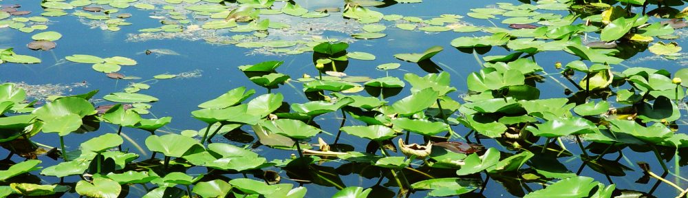
Free-floating plants (ff) – Non-rooted hydrophytes floating on or just below the water surface.
Hydrophytic plants – Plant species suited to grow in water or in saturated soil conditions.
Robust emergent plants (re) – Robust monocots from 1.5 to 3 metres in height which may be temporarily or permanently flooded at the base but are exposed at the upper portion.
Water-tolerant plants – Plant species that can grow in wetlands but can also grow in uplands.
Wetland Indicator Species – Species that are usually confined to wetlands in Ontario. Listed in Appendix 10.
Lesson 8
Absolute cover – This is the percentage of the ground surface that is covered by the aerial portions (leaves and stems) of a plant species when viewed from above. Due to overlapping plant canopies, the sum of absolute cover values for all species in a community may exceed 100 percent.
Hydric – For wetland evaluation purposes, hydric substrates are characterized by: rock, mineral or organic substrates with an ELC Moisture Regimes (MR) of ≥ 6, 7, 8, 9; or saturated rock, mineral or organic substrates (ELC category “s”); or an ELC MR of 5 (i.e, near-hydric), considered “moist” which may support hydrophytic or water-tolerant vegetation.
Relative cover – This is the cover of a particular plant species as a percentage of total plant cover. Relative cover will always tally up to 100%, even when absolute cover is quite low.
Lesson 9
Interspersion of vegetation communities – A measure of edge contact, or ecotone length, that exists between adjacent vegetation communities.
Plant form – Refers to the structures of plants, such as “robust emergents” and “free-floating” plants and so on, described on pages 62-63 of the OWES Manuals.
Polygons – The different shapes of plant communities can be drawn as polygons (closed geometric shapes, made of a series of straight lines, that represent the shapes of the actual plant communities) on a wetland map. The areas of those polygons can later be determined using GIS.
Vegetation community – An assemblage of plant populations living in a prescribed area.
Lesson 10
DEM – Digital Elevation Models are remotely sensed 3D representations of the Earth’s “bare ground” surface, used in OWES to examine the elevations (topography) of the land and water in and around a wetland.
DSM – Digital Surface Models are remotely sensed 3D representations of the reflective surfaces of trees, buildings, and other features that are elevated above the Earth’s “bare ground” surface. They are used in OWES to gain information about the taller vegetation (trees and shrubs) in and around a wetland.
GIS – A Geographic Information System (GIS) is a system designed to capture, store, manipulate, analyze, manage, and present spatial or geographic data. GIS is used to facilitate the evaluation of wetlands in OWES.
Infrared aerial imagery – Refers to aerial imagery obtained by using sensors that detect infrared light, instead of detecting visible light, for example. Many forms of vegetation reflect infrared light differently, allowing infrared imagery to be used to differentiate vegetation.
Orthophotography – Refers to aerial imagery that has been geometrically corrected, allowing it to be used to measure distances and areas within the image.
Polygons – The different shapes of plant communities can be drawn as polygons (closed geometric shapes, made of a series of straight lines, that represent the shapes of the actual plant communities) on a wetland map. The areas of those polygons can later be determined using GIS.
Remote sensing – Refers to the acquisition of information about an object without close physical contact, and thus in contrast to on-site observation. OWES makes use of a variety of images and information collected by satellite-based or aircraft-based sensor technologies to aid the process of evaluating wetlands.
Lesson 11
Hydric – For wetland evaluation purposes, hydric substrates are characterized by: rock, mineral or organic substrates with an ELC Moisture Regimes (MR) of ≥ 6, 7, 8, 9; or saturated rock, mineral or organic substrates (ELC category “s”); or an ELC MR of 5 (i.e, near-hydric), considered “moist” which may support hydrophytic or water-tolerant vegetation.
Substrate compared to soil – A substrate consists of any mineral, bedrock, coarse fragment, or organic materials, normally above water or covered by standing water that is less than two meters in depth. Soil is comprised of minerals and organic matter, liquids and gases, occurs on the surface of the land, and is characterized by horizons and the ability to support the growth of rooted plants.
Lesson 12
Endangered species – A species facing imminent extinction or extirpation in Ontario which is a candidate for regulation under Ontario’s Endangered Species Act. Listed as Endangered on the Species at Risk in Ontario List.
Mustelids – These are members of a family of carnivorous mammals including weasels, mink, otters and fishers; they are considered to be valuable furbearers.
Threatened species – A species that is at risk of becoming endangered in Ontario if limiting factors are not reversed. Listed as Threatened on the Species at Risk in Ontario List
Lesson 13
Wetland complex – A group of wetland units that are functionally linked to one another. The outer boundary of any one unit is no more than 750 m away from the outer boundary of one or more other units in the complex.
Wetland evaluation data and scoring record (WEDSR) – This is a 40-page detailed record of the sources of information and the scoring associated with each wetland that is evaluated (pp. 163-202 in the Southern OWES Manual; pp. 167-207 in the Northern OWES Manual).
Wetland evaluation file – A complete wetland evaluation file consists of the following items: 1. Wetland Evaluation Data and Scoring Record (WEDSR); 2. Five-page scoring summary; 3. Catchment basin map; 4. Map(s) of the wetland boundary and vegetation communities within the wetland; 5. Field notes; 6. Documentation of sources of information; 7. A copy of the map or digital file/program used to calculate interspersion; 8. Copies of completed Rare Species Reporting Forms; 9. Photographs; 10. Copies of collection labels; and more. (See p. 8 of the OWES Manuals.)